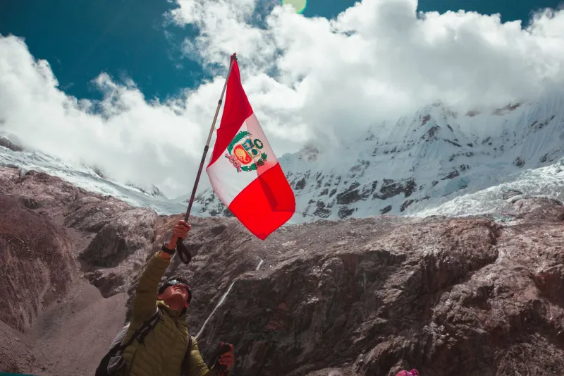
The Last Mile Is a Mule Trail: Six Andean Villages That Reward the Walk
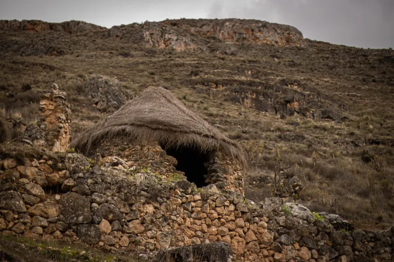
You can drive to a surprising amount of the Andes now. Paved switchbacks climb to 4,000 meters, minivans run to villages that were three days from anywhere in your parents' guidebook, and someone's cousin will always offer a ride in the back of a truck. Convenient, sure. But it's also why the villages still standing at the end of the footpath feel different — quieter, more self-contained, less rehearsed.
This is a guide to six of those places, drawn from the Peruvian and Bolivian high country. It is not a checklist. Two of the entries are clusters of communities rather than single dots on a map, and in every case the point is the same: you walk in, you stay a night or two, you spend money in the village instead of the trailhead parking lot, and you leave it the way you found it.
The Q'ero villages above Paucartambo
Hatun Q'ero, Quico, Marcachea and their neighbors sit high on the eastern flank of the Cordillera Vilcanota, roughly 4,000 to 4,400 meters, reached on foot from the Paucartambo side over two or three days. These are farming and weaving communities, not a living-history exhibit, and the distinction matters: families here work potato fields, run herds, hold fiestas, and travel to Cusco for school and market like anyone else.
Practically speaking, you go with a licensed guide who has a relationship with the community, you pay a community fee, and you hire mules or horses from the village itself. Turn up unannounced at the head of an unaccompanied group and you are, at best, a logistical problem. The long-established arrangement — guide, muleteer, community payment — is also the one that keeps the money local.
Cuncani and Quishuarani in the Lares Valley
North of the Sacred Valley, the Lares network of villages is reachable by a three- or four-day circuit out of Huarán or Lares itself, crossing passes around 4,200 meters before dropping to the hot springs. Cuncani and Quishuarani both run simple homestays: a bed in a family house, soup, potatoes, coca tea, and a rooster that has strong opinions about 4 a.m.
One honest note: the road is creeping up the Lares side, and the character of these walks has changed in the past decade. Go now-ish, and go with a local operator rather than a Cusco agency that subcontracts the whole thing. Ask who owns the horses and who cooks the meals. The answer tells you a lot.
Tapay and the terraces above the Colca
From Cabanaconde, most visitors drop into the Sangalle oasis, sleep by a pool, and climb out the next morning. Keep going instead. Cross the river and climb to Tapay, a village of stone houses and irrigated terraces pinned above one of the deepest canyons on earth. No vehicles. Supplies arrive on mules. The Colca tourist ticket covers the canyon area, and you'll register at the trailhead, but the walking itself is unpermitted and uncrowded — you mostly share the trail with farmers and the occasional donkey.
Build in an extra night. Tapay is where people who thought they were doing a hike end up sitting on a wall for four hours watching condors and clouds do their thing.
The far side of the Cordillera Vilcabamba
Huancacalle is the usual base for the walk to Vitcos and Ñusta Hispana, and from there the trail keeps going to Pampaconas and, for the committed, on toward Espíritu Pampa — the lowland site of Vilcabamba the Old, the last Inca capital, a four-to-seven-day proposition with river crossings and mud that has ended nicer boots than yours.
Traffic here is a fraction of the Inca Trail's, and the villages along the way see few foreigners. That means fewer services and less hand-holding. Go with an outfitter who knows the route and employs local arrieros, and treat the ruins as archaeology, not a photo backdrop — much of what you'll walk past is unexcavated and unprotected.
Llipi Llipi on Bolivia's El Choro route
Bolivia's El Choro trek drops from La Cumbre at about 4,700 meters to Chairo in the Yungas at 1,400, three days of pre-Columbian road, cloud forest, and knees doing things knees shouldn't. Llipi Llipi, partway down, is a small community with basic bunkhouse and camping arrangements and a snack shack that has saved more hikers than any gear list.
The Bolivia side runs on community fees, so carry small bolivianos and plan to pay at each trailhead checkpoint. Register at the entrance and again at the exit. Nobody's trying to catch you out; they're trying to account for who's still on the mountain.
Challapampa on the Takesi road
The Takesi is the other classic La Paz-to-Yungas walk, and Challapampa is the village where the old stone road, the llamas, and the cloud forest all seem to meet. You start near Ventilla around 4,600 meters and finish in Yanacachi. Same drill: community fee, register, cash, guide strongly recommended for a first visit.
The paperwork nobody mentions
Permits and fees vary by country and by trail, and they change. Assume you'll pay something at every trailhead, that a guide is required or effectively required for the Q'ero and Vilcabamba routes, and that protected areas in Peru have their own entry system on top of the local fee. Ask your operator, in writing, what's included: park entry, community fee, mule hire, cook, tip. Confirm what happens if a pass closes for weather or a fiesta.
Altitude, money, and what to pack
Sleep at 3,400 meters for two nights before any of these walks, and don't treat the first pass as a fitness test. Bring layers rather than a parka, a real rain shell, high-UV sunglasses, a filter or treatment tablets, and cash in small bills — there are no ATMs and no card readers. A sleeping bag rated for freezing is smart in Bolivia even in the dry season. May through September is the reliable window; June brings fiestas and, in some villages, closed doors.
Pay fairly. A homestay night in these villages runs somewhere between $10 and $30 with meals, and haggling over that is a bad look. Tip muleteers and cooks directly.
What these villages are not
They are not photogenic poverty for your feed. They are not always open — harvest, funerals, and fiestas outrank guests. They are not spas, they rarely have reliable Wi-Fi, and the meals are what the family is eating. There's no plaque explaining anything, and nobody owes you a story about their grandparents.
What they are is the reason to walk the last mile instead of taking the truck. Bring a book, learn eight words of Quechua or Aymara, and be the kind of guest who gets invited back.