Follow the Water, Not the Bootprints: A Hiker’s Guide to Andean Irrigation Channels
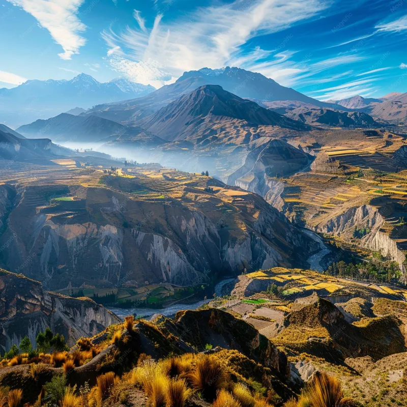
Photo: Andean irrigation canal stone channel highlands village Peru, via img.freepik.com
On a high ridge in the Andes, the path narrows to a slick, smooth ribbon about eighteen inches wide. It curves around the hillside with the confidence of a trail that knows exactly where it’s going. It is not a trail. It is a canal. And somewhere below, a family is waiting for that water to reach a potato field, a greenhouse, or a stone tank behind a house.
If you’ve spent time around the acequias of northern New Mexico or the irrigation ditches of Colorado’s San Luis Valley, the scene will feel familiar. Hand-dug channels, community maintenance, water shared by turns. The difference is altitude, and the fact that a wrong step here can cost a neighbor a day’s supply. The canal is not a photo prop. It’s the local plumbing.
It Looks Like a Trail Because It Was Built by Feet
These channels were not surveyed by engineers with laser levels. They were cut by people walking the contour of the slope, testing the grade with their eyes and their boots. Over generations, the berms got packed down, the edges got trimmed, and the whole thing settled into a line that reads—to a tired hiker—like a path.
That resemblance is the trap. A canal berm is a dam in miniature. Walk on it, and you compact the soil, crush the grasses holding it together, and create a low spot. Water finds low spots. A pinhole leak upstream becomes a muddy seep downstream, and a muddy seep becomes a washed-out bank. Multiply that by every hiker who takes the obvious route, and you have a real problem for the people who rely on the channel.
Three Clues That You’re Looking at Infrastructure
First, watch the grade. A trail generally goes somewhere—up to a pass, down to a village, across a valley. A canal runs almost level, tracing the hillside like a contour line on a map. If the “path” stays stubbornly horizontal while the slope rises and falls around it, you’re probably walking a water line.
Second, look at the edges. Canal banks are often trimmed, mossy, or lined with wet stones. You might see a small stone or concrete gate—a compuerta—controlling flow into a side channel. You might see a notch in the bank where water spills into a field. What you won’t see, usually, are bootprints. Locals walk beside canals, not on them.
Third, follow the destination. A trail leads to a viewpoint, a village, a col. A canal leads to a field, a tank, a cluster of houses. If the line ends at a potato patch instead of a pass, it’s not your route.
The Berm Is a Wall, Not a Sidewalk
This is the part that takes some getting used to. In dry, open country, the berm of a canal can be the easiest walking surface for miles. It’s flat. It’s clear. It’s right there. But it’s also the structural wall that keeps water moving in the right direction.
Walking on a berm is like walking on a roof. You might not fall through, but you’re adding stress to a surface that wasn’t designed for you. In unlined channels, foot traffic loosens the soil and invites erosion. In lined channels, it can crack the mortar or shift the stones. Either way, the repair work falls on the community, usually during the dry season when everyone already has plenty to do.
Gates Are Not Doors
A compuerta is not a gate you open because you’re curious. It’s a valve in a system of water rights, scheduling, and neighborly agreements that may be centuries old. Opening it can flood a field, starve a downstream user, or empty a tank that someone filled yesterday. Leave it alone. If it’s closed, there’s a reason.
How to Cross Without Becoming the Problem
The best crossing is the one the locals use. Look for a culvert, a stone slab, a pair of logs, or a narrow spot where the banks are reinforced. In many villages, you’ll find a simple bridge exactly where the canal meets a footpath. Use it.
If there’s no bridge and the canal blocks your way, don’t jump across and don’t wade in. Jumping can collapse the bank. Wading stirs up sediment and can damage the channel bed. Instead, walk to the nearest field edge or house and ask. A simple “Buenos días, ¿me permite pasar?” goes a long way. So does “¿Hay un puente?”—is there a bridge?
Asking Is the Shortcut
In the Andes, the social route is often faster than the topographic one. A greeting, a pause, a question—these are not delays. They’re the price of admission to someone else’s water supply. If a farmer waves you toward a crossing, take it. If they wave you away, believe them. There may be a turno—a scheduled water turn—in progress, and your shortcut can wait.
If You Accidentally Damage Something
It happens. A stone shifts. A bank crumbles under a boot. The worst response is to pretend you didn’t notice. The next worst is to try to “fix” a gate or a diversion on your own. Tell the nearest household. Apologize. Ask if there’s anything you can do. In small villages, honesty is worth more than a perfect record.
The Takeaway
Treat an Andean canal the way you’d treat a neighbor’s irrigation ditch back home: with respect, a little curiosity, and a refusal to walk on the berm just because it looks convenient. The water knows the way. Your job is to let it go.